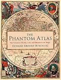
West of Ireland, on chart after chart, there used to be an island.
It had names that wandered (Brasil, Hy-Brasil, O’Brazil, Brazil Rock) and a shape that sometimes went circular, as if someone had pressed a cup into wet ink. Folklore said the place appeared one day in seven, or not at all, in fog. Portolan charts from the early fourteenth century already had it sitting in the Atlantic like a fact. Expeditions left Bristol. Gentlemen spent money. In 1873 the British Admiralty, tired of an island that would not hold still under a lead line, took it off the working sheets.
The maps had been more durable than the land. That is the secret life.
A sheet of geography is never a miniature of the ground. In 1933, in Science and Sanity, Alfred Korzybski put the idea into a sentence people still steal: the map is not the territory. Cartographers knew it in their hands already. If the drawing were as large as the county, you would be standing on it, which is a poor way to find the harbor.
This page is about that argument: how a line on vellum or copper can make a mirage official, a theology look navigable, and a subway more usable than the streets. How a fantasy novel teaches you to feel distance before chapter one is a sibling craft, owned next door. The blank that is more wonderful than the named kingdom is another. Stay here for the maps that believed in Hy-Brasil hard enough to send ships.
North does not have a natural right to the top of the page
Modern readers treat north-up as physics. It is etiquette with a compass behind it.
Medieval European world maps often put east at the top: sunrise, Eden, the direction buried in the word orientation. Muhammad al-Idrisi’s 1154 world map for Roger II of Sicily, the Tabula Rogeriana, is famously south-up. Other traditions have pointed the sheet toward a sacred city, a river’s source, or an emperor who sits in the north and looks south over his people. Once you have seen a south-up Mediterranean, a north-up phone map looks like a habit you could break.
Flat maps of a sphere also have to choose which truth to betray. Mercator keeps local angles fit for a rhumb-line course and inflates the near-Arctic until Greenland looks like a continent. Equal-area projections keep Africa’s bulk honest and stretch shapes until the tropics look pulled. Compromise projections (Robinson, Winkel Tripel) are diplomatic lies. None of them is “the real world.” Each is a job.
Scale language is a trap with a punchline. A large-scale map (1:1,000) shows a small place in high detail. A small-scale map (1:20,000,000) swallows a hemisphere and deletes your street. The fraction is smaller; the world on the page is bigger. Fantasy atlases that begin as tiny-scale continents often feel empty because they skipped the scale where a river still has banks.
A calfskin encyclopedia is not a bad GPS
The Hereford Mappa Mundi (about 1300) is a circle of vellum roughly five feet across. It will not get you to Hereford from France. That was not the assignment.
Medieval T-O maps treat the inhabited world as a disk: ocean as the O, a T of waterways dividing Asia (top, east), Europe, and Africa, with Jerusalem as a theological navel. Hereford loads that schema with salvation history, classical rumor, and natural-history gossip: Ark, Babel, Hercules, monstrous races at the hot edge of Africa. It is a library that happens to be round. Calling it inaccurate is like calling a cathedral a failed warehouse.
Meanwhile, from the thirteenth century, Mediterranean sailors were using portolan charts: animal-skin working surfaces dense with compass roses and rhumb lines, coastlines that still startle, names written inland and perpendicular to the shore so the water stayed clear for a pair of dividers. Important harbors in vermilion. Lesser ones in black. A portolan is ruthless. A mappa mundi is devout. Fantasy maps that feel both mythic and usable are, knowingly or not, living in that split.
Star atlases do a third job: they map a sphere we cannot walk. Different gods. Same temptation to make the unknown look labeled.
The dragons were mostly unemployed
People love to say medieval maps wrote “Here be dragons” in the blank bits. The Latin HC SVNT DRACONES turns up on a pair of early sixteenth-century globes (the Lenox Globe and the so-called Ostrich Egg Globe), off Southeast Asia. That is a thin employment history for a cliché. Terra incognita did more of the work.
Sea beasts, when they appear, are rarely doodles. Chet Van Duzer’s work on the subject is the right skepticism: Olaus Magnus’s 1539 Carta Marina uses whales and horrors as natural history, as warning (Lofoten is not a swimming pool), and as luxury for patrons who wanted a wall to brag. The monster is information with teeth.
Phantom islands are the stranger employment. Frisland rode the 1558 Zeno map into Mercator and Ortelius, a copy-loop with a coastline. Sandy Island in the Coral Sea survived into digital charts until a 2012 survey sailed through deep water; popular retellings like to pin the original blot on Cook in 1774, which may be more story than hydrography. Atlantis is not in this club. Plato’s island in Timaeus and Critias is a philosophical device. Later maps that draw it are literature wearing a compass rose.
Hy-Brasil remains the perfect specimen because it sat in a busy ocean, kept a fairly stubborn latitude, and still would not hold a boot.
Some maps are more true by lying harder
In 1881, stuck indoors in Braemar, Robert Louis Stevenson painted an island in watercolor with his stepson Lloyd Osbourne. Harbors pleased him “like sonnets.” Characters began to appear out of the wood. Treasure Island is what happens when a map is allowed to boss a plot: fever-swamp, spyglass, stockade, the red X as a narrative engine. That origin is a rainy holiday, not a lecture on worldbuilding software.
In 1931 Harry Beck, an engineering draughtsman, offered London Underground a diagram that abandoned surface geography. Stations sit on a grid. Lines turn at tidy angles. The Thames is a suggestion. Issued in 1933, it taught millions that the useful truth of a network is sequence, not walking distance. Every transit map that looks “wrong” and works is in his debt.
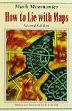
Copperplate, woodcut, and GIS are only tools for the same old decision: what to omit. Mark Monmonier’s How to Lie with Maps is blunt on purpose. Color, projection, and a chosen scale can start a war or sell a holiday.
If you are here because you want mountains to cast rain-shadows and rivers to refuse to split toward two oceans on a plateau, that grammar is real and it will save a drawing. It is also how-to, and the locked book-map essay is the better door for the novelist’s contract with a reader. This page’s souvenir is ruder.
Tomorrow, on any map you actually use, look for the island that is still there out of courtesy, the blank that is doing theology, and the corner where north is only a habit. If a chart can outlive a place, it can also invent one. Hy-Brasil is gone. The habit of believing the paper is not.